This aerial map is a plan of the diamond drill core holes needed to properly assess the 100' level of Morefield mine.
The purpose of this core hole plan is to assess how far the pegmatite minerals run, and to assess what type of minerals can be found at various locations in the mine. The 100' section, which had been built out by the US Bureau of Mines after World War II, has often been flooded. Understanding the value of what is down there justifies the need to pump that significant amount of water out.
The hand notations are to "Billy"--presumably Bill Baltzley. It refers to the diabase dyke at about 90 ft northeast (NE) of the main shaft. The 100' level is at 176.5' altitude. Each place it says "test round" refers to core that would be dug out.
The second photo gives some more context of the results of the core drilling.

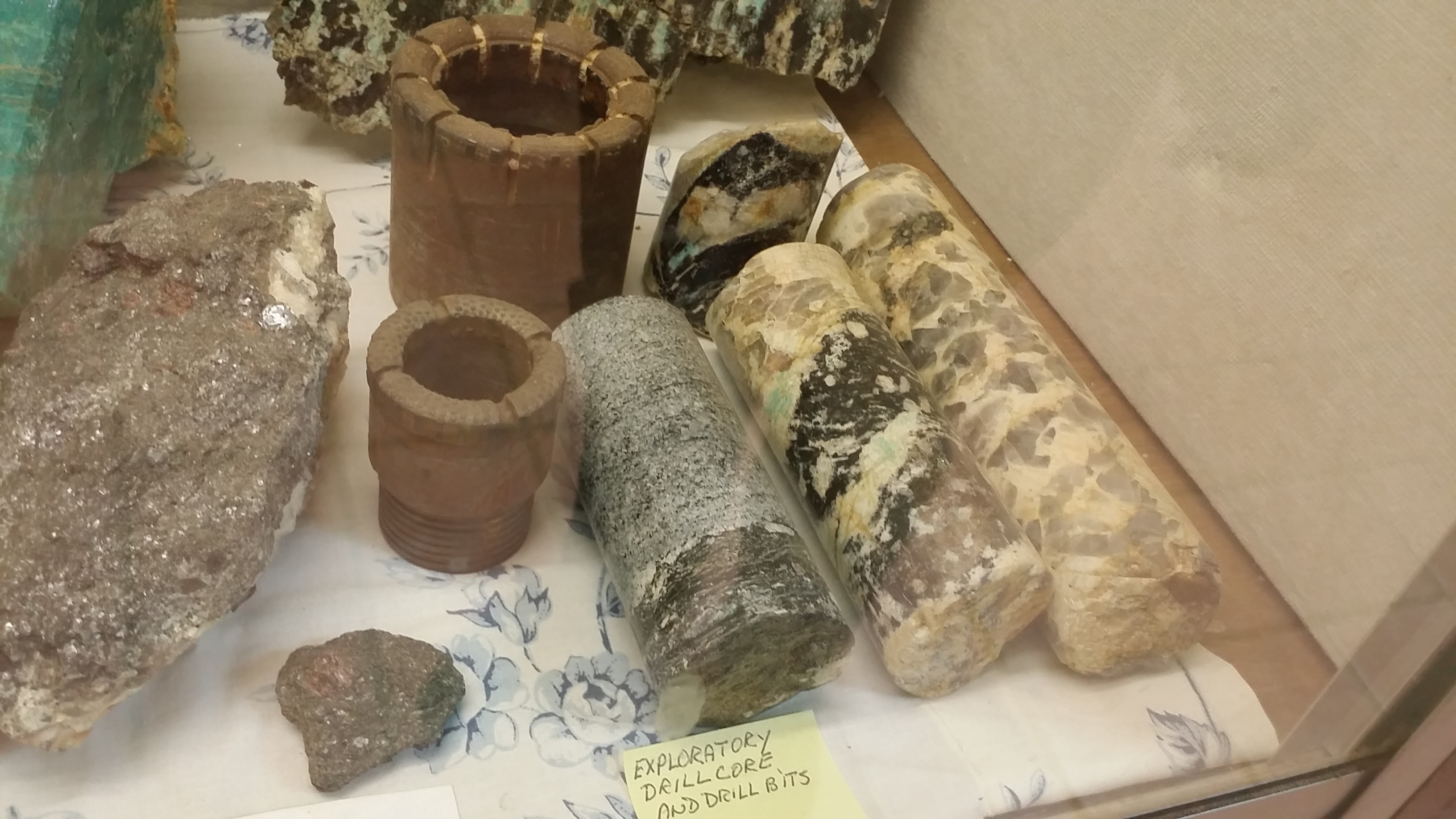
⤴️This photo demonstrates both the diamond drill bits used to create the exploration drill cores, in addition to some of the actual cores.
In the left one, you can see the diabase (black). In the middle one, you can see the point of contact where the Microcline var. Amazonite connects with the diabase; smoky quartz surrounds them at both ends. In the right one, you can see mostly smoky quartz and probably albite.